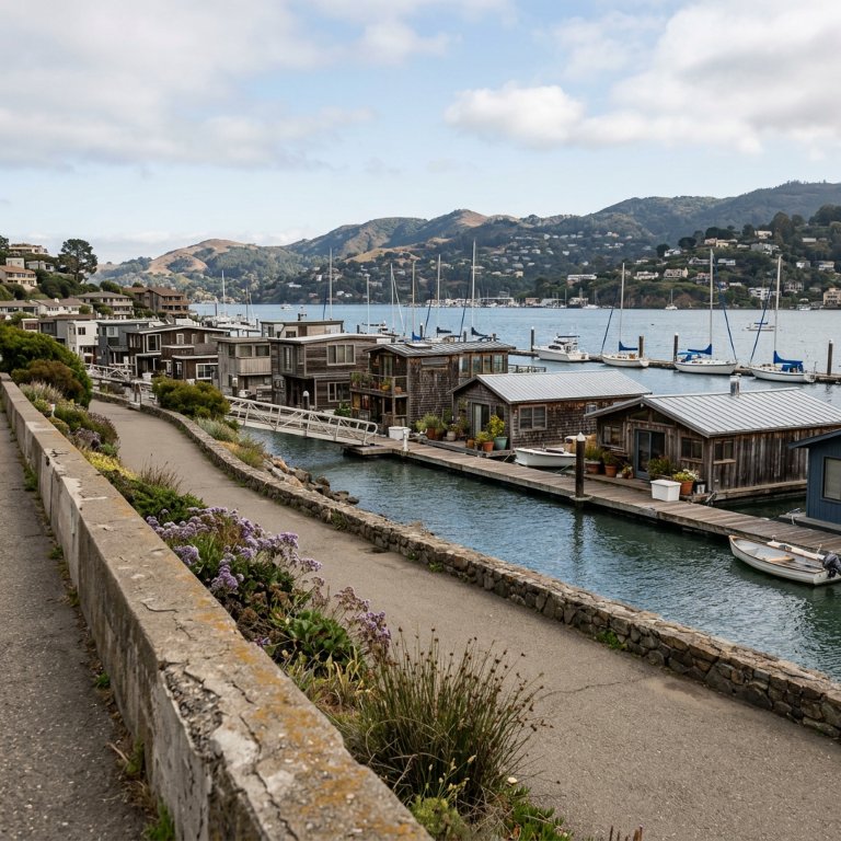
Richardson Bay & the Marinship Walk
Sausalito, United States
This waterfront walk follows Sausalito’s harbor edge from the ferry landing to the former wartime shipyards, blending promenade views with stories of sailors, artists, engineers, and shipbuilders. Along the way, maritime landmarks, floating homes, marinas, and scientific curiosities reveal how a small anchorage became an artsy harbor town shaped by the bay. Expect constant water views, layered history from the nineteenth century through World War Two, and a living shoreline where commerce, creativity, and navigation still meet.
The stops
- 01 Sausalito Ferry Landing
A transportation gateway that also functions as a front-row harbor promenade, where arrivals, departures, and views become part of the town’s identity.
- 02 William Richardson
William Richardson was the British-born sailor and entrepreneur after whom Richardson Bay is named. He is regarded as an early settler in the Sausalito area and a key figure in its early history.
- 03 Old Sausalito City Hall / 1894 Old City Hall
The 1894 Old City Hall in Sausalito is a historic civic building associated with the town's early municipal government. It is one of Sausalito's notable preserved 19th-century landmarks.
- 04 Sausalito History Timeline
A compact interpretive stop that helps visitors connect the waterfront to Sausalito’s layered past, from maritime activity to arts and tourism. It works well as a context-setting anchor early in the walk.
- 05 Sausalito house boats
A signature Sausalito scene that combines maritime heritage, residential creativity, and strong tourist appeal. The houseboat community adds a distinctly local character to the waterfront experience.
- 06 Point Bonita Light Station
A classic historic beacon that speaks directly to California’s maritime navigation story and rewards visitors with dramatic coastal scenery. It strengthens the tour’s heritage-and-viewpoint balance.
- 07 Schoonmaker Point Marina
One of the clearest expressions of Sausalito’s living harbor culture: slips, masts, reflective water, and the everyday rhythm of boats at rest.
- 08 Schoonmaker Beach
A quiet shoreline pause that connects promenade walking with the bay’s more reflective edge, where water, birds, and boats share the same frame.
- 09 U.S. Army Corps of Engineers Bay Model
The U.S. Army Corps of Engineers Bay Model is a working hydraulic scale model of the San Francisco Bay and Sacramento-San Joaquin River Delta System.
- 10 Marinship Way
A waterfront street that threads through the former shipyard landscape, useful for reading the industrial footprint that still shapes the harborfront.
- 11 Marinship Park
A key entry point into Sausalito’s wartime shipbuilding story, with open bay views and traces of the industrial waterfront that transformed the town during World War II.
The narration at every stop is in the app — this is the map of where it takes you, with a line on each stop.
Walk Richardson Bay & the Marinship Walk with a voice in your ear.
Download Odyssey Guide on iPhone to start this walk.
Download on the App StoreiPhone · iOS 16 and later